
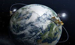
Remote Sensing & GIS of Environment
Remote sensing of Environment serves the remote sensing community with the publication of results on theory, science, applications and technology of remote sensing of Earth resources and environment. Thoroughly interdisciplinary, this is a terrestrial, oceanic, and atmospheric sensing. Remote sensing data provide a synoptic view of many environmental trends. Remotely sensed imagery can provide both snapshots and data over that time address environmental issues at global, regional and national scales. It can provide these in consistent formats and in ways that complement national-level data collection efforts, which are often under-resourced and inconsistent from country to country. Remote sensing can contribute to global assessments in support of MEA’s. Remote sensing provides timely information on a large and growing number of environmental issues such as land-use/land-cover change, carbon-monoxide plumes, and the carbon density of ecosystems, which can significantly contribute to global environmental assessment in support of MEAs (e.g., the Inter-governmental Panel on Climate Change and the Millennium Ecosystem Assessment). GIS can refer to a number of different technologies, processes, and methods. It is attached to many operations and has many applications related to engineering, planning, management, transport/logistics, insurance, telecommunications, and business. For that reason, GIS and location intelligence applications can be the foundation for many location-enabled services that rely on analysis and visualization.
- Applications of Remote Sensing
- Impact factor of remote sensing of environment
- Geophysical investigation of landslides
- Soil investigation methods
Related Conference of Remote Sensing & GIS of Environment
Remote Sensing & GIS of Environment Conference Speakers
Recommended Sessions
- Archaeology
- Ecology & Environmental Engineering
- Economic Geology & Geochemistry
- Environmental Geology
- Environmental Sustainability
- Geology and Geophysics
- Geology in Civil Engineering
- Global Warming & Climate Change
- Groundwater Foundation & Hydrology
- Marine Geology & Oceanography
- Mining and Soil Exploration
- Natural Hazards & Disaster Management
- Oil and Gas Reservoir
- Paleontology & Paleo-anthropology
- Petroleum Geology
- Remote Sensing & GIS of Environment
- Sedimentology Geology & Stratigraphy
- Soil and Rock Mechanics
- Structural Geology
- Volcanology & Plate tectonics